


Severe Weather Threat for June 16, 2025 for Eastern S.D. , SW Minn., NW Iowa
National Weather Service Warns of Severe Storms, Heavy Rain Today and Tonight; Thunderstorms could bring hail, damaging winds and flash flooding

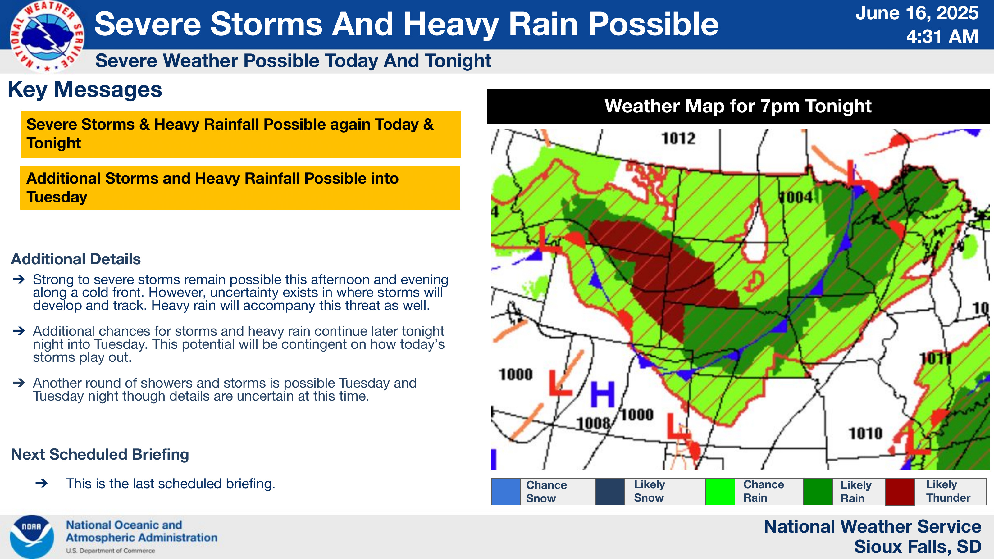
NWS graphic.
(Broadcast readers after the main story.)
By Todd Epp, Northern Plains News
The National Weather Service in Sioux Falls reports a “moderate” chance of strong to severe storms across eastern South Dakota, northwest Iowa, and southwest Minnesota Monday afternoon and evening.
Issued at 4:31 a.m., the briefing warns storms may form along a cold front from Yankton to Marshall and intensify into a line capable of producing “hail up to golf ball size” and “damaging wind gusts of 70 mph.” While the threat of tornadoes remains low, the report notes “an isolated tornado or two may be possible.”
Forecasters also highlight the risk of heavy rainfall. The report states that the region could receive 1 to 2 inches of rain, especially in areas already affected by weekend storms that dropped 2 to 5 inches, raising concerns about flash flooding.
The Storm Prediction Center has placed eastern South Dakota under a Level 3 (Enhanced Risk) for severe weather today.
When and Where
- Timing: Moderate confidence in storm development from 1 p.m. to late evening, with lower confidence on precise timing.
- Hail risk: Up to golf ball size, capable of causing property damage.
- Wind threat: Gusts reaching 70 mph, enough to damage trees, power lines and outdoor items.
- Rainfall: 1 to 2 inches; potential for localized flash flooding if storms repeatedly track over an area.
Public Safety Reminder
The briefing advises: “Be weather aware and ready to act. Have multiple ways to receive warning information!”
—30—
:30 Broadcast Reader
The National Weather Service says eastern South Dakota faces a moderate risk of strong to severe storms today.
Forecasters warn of hail up to golf ball size, wind gusts reaching 70 mph and heavy rain that may cause flash flooding.
The area is under a Level 3 Enhanced Risk.
Officials urge residents to “be weather aware and ready to act” with multiple warning sources.
:10 Broadcast Reader
Severe storms may bring hail, 70‑mph winds, and flash flooding today in eastern South Dakota—residents urged to stay weather aware.